We use Cookies. Read our Terms
- News
- How drones are revolutionizing agriculture
How drones are revolutionizing agriculture
The food system is a major contributor to climate change. Technology is key to the significant shifts in global production and consumption that are needed to meet the Paris targets

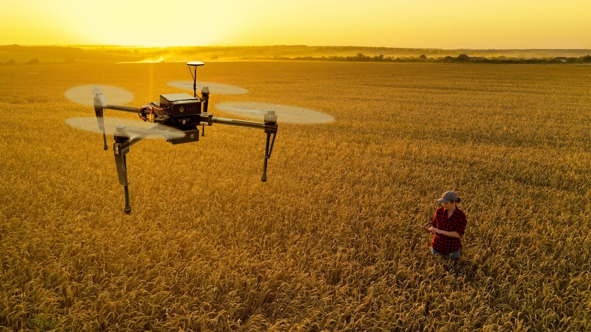
Photo: Scharfsinn/Shutterstock
Food systems are deeply entwined with the climate crisis: they are both impacted by climate change and, at the same time, major contributors to the problem.
A 2021 report by the World Bank entitled What’s Cooking: Digital Transformation of the Agrifood System explores how digital technologies can improve the food system. “The digital revolution has enormous potential for transforming the agriculture and food system in ways not previously seen – by drastically lowering information asymmetries and transactions costs that plague the system, and, as a result, improving the lives of farmers, as well as the nearly eight billion people who depend on them for food,” says Task Team Lead Kateryna Schroeder, an agriculture economist.
One new approach, made possible thanks to technological advances, is so-called precision agriculture. The term describes a farming management concept based on observing, measuring and responding to inter and intra-field variability in crops. To date, precision agriculture techniques have been accessible for the most part only to large-scale farmers for whom the economies of scale warranted the investment in what used to be expensive hardware and services. Now, innovative solutions that leverage free satellite data are starting to become more affordable and thus more widely available.
The potential of drones
In an effort to mitigate climate change, development practitioners are increasingly looking into the potential of Unmanned Aerial Vehicles (UAVs), commonly known as drones.
After agricultural aircraft have been in use for more than a hundred years, the use of satellites to assess crop health from the sky has increased in recent decades. The continuing reduction in cost, size, and complexity of drones mean that farmers could leapfrog from more traditional methods of agriculture to precision agriculture.
The use of drones provides large benefits by improving the environmental sustainability of agricultural operations through minimizing environmental damage from agriculture, for example, by reducing nitrate leaking, improving water-use efficiency and increasing fuel efficiency.
In addition to precision agriculture applications drones offer a wide range of promising ways to enhance the management of agricultural assets more broadly: they can improve the monitoring of livestock, fences, trees, and wildlife, and help farmers document their farms to improve their creditworthiness.
A key factor in enabling an increase of, and efficiency in, food production is providing farmers with relevant information. Drones allow farmers to gain a birds-eye view of their crops, permitting them to detect subtle changes that cannot be identified at ground level. Moreover, multispectral imaging enables drones to pick up on crop conditions that are not always clear to the human eye, such as water stress, fertilizer needs, pest infestations, and diseases.
Drones are equipped with specialized sensors that can collect multispectral images that are used to generate data on crop quality such as the Normalized Difference Vegetation Index – an index that describes and measures the greatness and density of the vegetation captured in a satellite image.
Factfile: Drone technology in action
In Nigeria, drone technology accelerated the planning, design, and construction of rice irrigation systems. Teams planning a 3,000-hectare irrigated rice farm near New Busa, some 700 km from the country’s capital Abuja, used drone imagery to make decisions on the layout of both rice paddies and irrigation and drainage systems. Thanks to the drone imagery, they were able to quickly determine that their original design was poorly suited to the available terrain. Nearly 1,000 hectares could be covered in a single day; in comparison, it would have taken a professional surveyor working on foot about 20 days to cover the same area.
In Malawi, recurring droughts have ravaged the agriculture sector, threatening the livelihoods of smallholder farmers, who constitute 80 percent of the population. High-precision aerial photography captured by drones and weather station data have been used to analyze and predict crop yields. The imagery allowed researchers to find ways to enable the development of more appropriate solutions.
In Mozambique, the Third-Eye: Flying Sensors to Support Farmers’ Decision Making project generated information for 2,800 smallholder farmers, mostly women, covering 1,800 hectares of land, helping to improve the famers’ decision-making regarding when to plan, fertilize and irrigate. The farmers recorded a 41 percent increase in crop production and a 55 percent increase in water productivity.
Drones can potentially increase the security of livelihoods by enabling better prediction of seasonal and environmental patterns and recommendations for solutions to low crop yields using data gathered via multispectral aerial images. For example, when used in precision spraying of crops, drones provide operational efficiency equivalent to the work of 100 farmland workers.
The use of drones in agriculture is steadily growing as an effective approach to sustainable agriculture management that allows players to streamline their operations, using robust data analytics to gain effective insights into their crops. In particular, drones are expected to provide significant help to farmers in developing countries.
For society at large, agricultural transformation, enabled by drones and other digital technologies and data, will likely result in lower prices, and improved market links will result in greater access to nutritious food.